Assam Floods: Natural Disaster Turned into Mafia-Made Catastrophe
Bhupen Sarmah
THE ecology of Assam is characterised by a large network of rivers and tributaries originating from the hills of Arunachal Pradesh, Meghalaya, Nagaland, Mizoram, Manipur, and the neighbouring country of Bhutan, which join the Brahmaputra and Barak rivers to form a highly dynamic and complex river system. The Brahmaputra and its tributaries, together with the Barak river system, inundate large areas of the plains of Assam almost every year during the monsoon. As an integral part of the state’s ecological system, flooding in Assam is essentially linked to several important issues pertaining to floodplain management, riverbank erosion, wetland conservation, urbanisation, embankment policy, agricultural vulnerability, and long-term disaster management.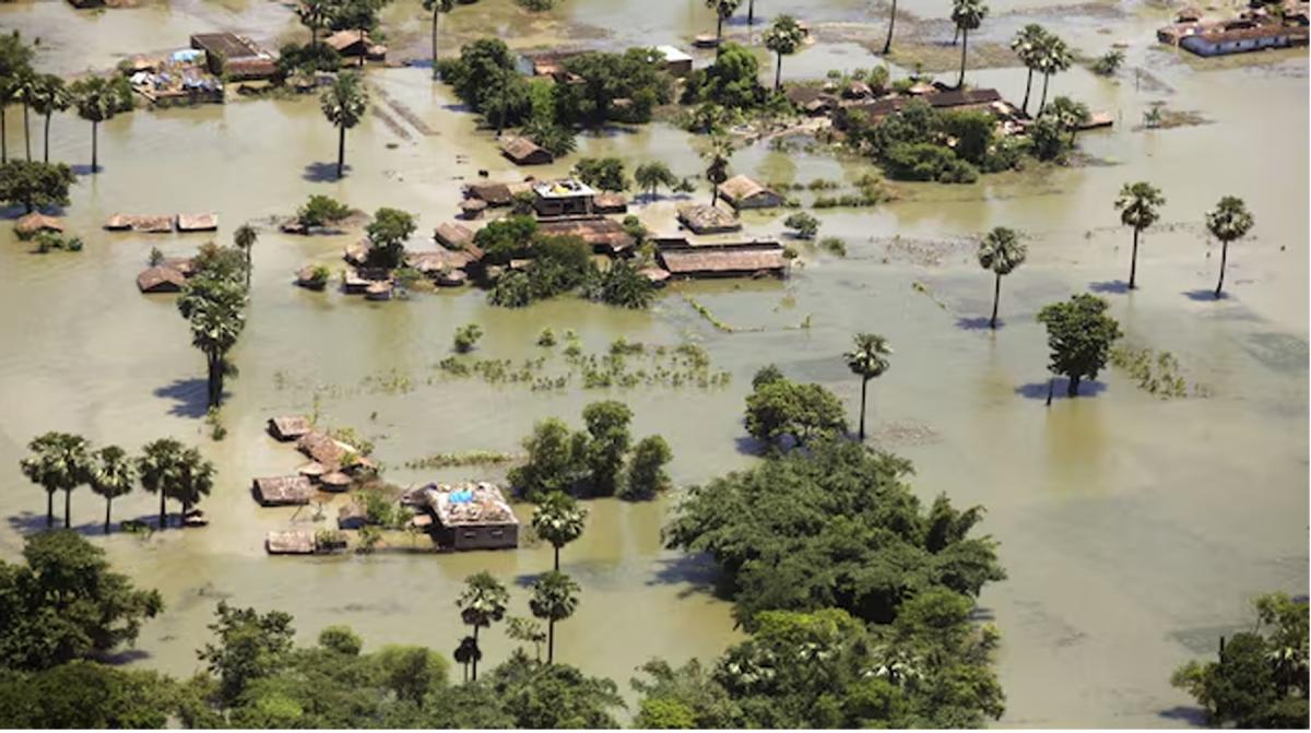
RECURRING NATURE OF FLOODS IN ASSAM
Floods in Assam have generally been perceived as a persistent natural hazard. The flood-prone area of the state, as assessed by the Rashtriya Barh Ayog, is 31,500 sq km, which is about 39.58 per cent of the total land area of the state and constitutes nearly 9.4 per cent of the total flood-prone area of the country. One of the worst episodes of flooding occurred in 2019, when more than 73 lakh people were affected. Similarly, floods affected nearly 58 lakh people in 2020 and 57.50 lakh people in 2022.
The flood situation in the state was equally severe in 2024. According to official sources, nearly 43 lakh people in 7,794 villages were affected, and the combined death toll from floods and landslides was 121. Demonstrating its recurring character, Assam witnessed three distinct waves of flooding in 2025. The first wave, from May 31 to July 22, affected 2,630 villages and 1,04,123 people, resulting in 24 deaths. The second wave affected 45,930 people, while the third affected 1,08,232 people and caused another two deaths. These are only few instances of the recurring nature of floods in Assam.
Flooding is usually accompanied by both river-bank erosion and heavy sedimentation resulting in large-scale displacement of people with visible demographic implications. Therefore, floods in Assam must be comprehended taking into account all the associated socio-economic crises, enormously affecting agriculture, housing, livestock, infrastructure and livelihoods.
MAJOR CAUSES
Floods and riverbank erosion, the most persistent environmental and socio-economic problems of Assam, are undoubtedly rooted in the exceptional hydrological and geomorphological characteristics of the Brahmaputra and Barak river systems. The Brahmaputra and its numerous tributaries such as the Subansiri, Ranganadi, Dikhow, Dhansiri, Jia-Bharali, Manas, Beki, Aie, Sankosh, to name only few, flow through Assam and can rise rapidly following intense rainfall in their respective upper catchments. However, floods in Assam cannot merely be attributed to intense rainfall in a particular year, while ignoring the geomorphology of the state, which is heavily influenced by a complex network of the river systems and consequent sedimentation, the continuous degradation of wetlands caused by changes in land use, and unplanned and unscientific human interventions in riverine environments. The resultant crisis arising from the combination of these factors has now been further aggravated by global warming, making the problem increasingly intense as well as complex.
THE ADDED DIMENSION OF THE MAFIA
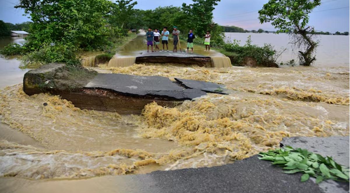
The recent episode of flooding witnessed in the Upper Assam districts of Sivasagar, Charaideo and Jorhat was unique in terms of both the speed and depth of inundation. By July 20-22, this severe and unusually destructive flood had heavily damaged or submerged tens of thousands of hectares of agricultural land, while the total death toll had climbed to over 100. It affected hundreds of thousands of people, many of whom had never experienced such a disaster before.
As initially reported by official sources, the devastating July flood was triggered by intense cloudbursts and extreme rainfall along the Assam–Nagaland border. This claim, however, is only partially convincing, and the devastating episode cannot be considered merely an annual natural calamity. Besides raising questions about the adequacy of conventional flood-control measures, the need for integrated river-basin management, effective floodplain planning, embankment maintenance, erosion control, early-warning systems, etc., the recent floods experienced by the Upper Assam districts also exposed the potentially dangerous consequences of large-scale, organised and illegal extractive activities.
As reported by various unofficial sources, extensive and allegedly unregulated extraction of coal and stone in the hill areas bordering Assam and Nagaland intensified the flooding in Upper Assam. Rampant coal mining and stone quarrying, involving extensive excavation along river-valley sides, may have generated large quantities of loose sediment and mud, while also substantially reducing the carrying capacity of rivers. Allegedly, such illegal activities have been spearheaded by some of the top political leaders of the present BJP government in the state, thereby turning a natural disaster into what may be described as a “mafia-made catastrophe.”
RESPONSE OF THE STATE AND THE CENTRAL GOVERNMENT
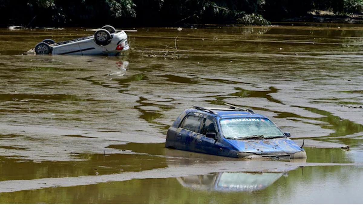
The response of the BJP government in the state to the devastating floods has been remarkably casual, being confined to some rescue operations, the establishment of a few relief camps, the distribution of food, and the announcement of ex-gratia assistance for the families of those who died in the floods. At the height of the crisis, which severely affected nearly ten lakh people, relief had not reached tens of thousands of victims, as the official relief machinery failed to respond adequately to the magnitude of the crisis. The severity of the disaster, especially in Sivasagar, Charaideo, and Jorhat, exposed the lackadaisical approach of the BJP government. A large number of flood victims had to depend almost entirely on relief operations carried out by different sections of the people across the state and by other political organisations. The role played by the CPI(M) and other mass organisations, especially SFI, DYFI and CITU, has been remarkable. In addition to the immediate supply of essential materials to a large number of flood victims, the party and other mass organisations also arranged paddy seedlings for farmers in many affected areas. On the contrary, while innumerable people affected by the floods are still grappling with survival, the BJP government in the state is planning to celebrate Narendra Modi’s birthday by distributing copies of the Ramayana and Mahabharata to 40 lakh families in Assam.
Needless to say, floods in Assam are not an occasional phenomenon but a recurring structural disaster affecting agriculture, livelihoods, settlements, infrastructure, and the overall economy of the state. However, the response of the Government of India has largely been confined to providing inadequate support for emergency relief rather than addressing the underlying structural issues. Such support primarily comes through the State Disaster Response Fund (SDRF) and the National Disaster Response Fund (NDRF). The inadequacy of such support is evident from the fact that the accumulated damage and losses suffered by the state between 2014 and 2024, as estimated by the Government of Assam, amounted to more than Rs. 37,780 crore while the total amount demanded by the state from the Union government during the period was Rs. 27,270 crore. However, the cumulative amount released by the Government of India to the state was only Rs. 6,542.83 crore, which amounted to merely 17 per cent of the estimated losses and damage.
Nevertheless, attracted by the enormous hydropower potential of the Brahmaputra basin, the Government of India has facilitated the construction of a large number of dams in the mountainous upper catchments of Arunachal Pradesh. These dams were constructed without any cumulative impact assessment at the sub-basin and basin levels. Consequently, the downstream implications of such dams and hydropower projects for Assam remain inadequately assessed. One such unresolved issue is the Subansiri Lower Hydroelectric Project, a 2,000-MW project comprising eight 250-MW units, located on the Subansiri River at the Assam–Arunachal Pradesh border and implemented by NHPC. The BJP vehemently opposed the project during the process of its construction until 2014. However, after coming to power, the same party began championing the project. Two units of the project have already been commissioned, while the remaining units are planned for phased commissioning through December 2026.
It is, therefore, amply clear that the recurring floods in Assam are the product of a complex interaction between natural river dynamics and a multitude of unscientific and unplanned human interventions. The catastrophic floods in the state cannot be managed by the government of Assam alone; they demand concerted efforts of the Government of India and the governments of the neighbouring states of Assam. However, the approach of the ruling BJP must be scientific and holistic. Jettisoning the daydreams of the Union Home Minister of making Assam” flood-free” by adopting a plan to convert floodwaters into ponds and other water reservoirs, the government of India must adopt a scientific and comprehensive approach to managing the recurring problem.


